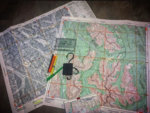
Land Nav questions

JigStick

WKR
Joined
Aug 26, 2016
Messages
337
Location
Pittsburgh
Have a few questions. Trying to teach myself some land nav

I have a 1:24,000 topo of the area I’m scouting with full UTM grid overlay

I have a Garmin GPS

I have a Suunto MC 2G declination adjustable compass

to “calibrate” my compass to this map should I be adjusting the declination for true north, grid north, both???

if I’m taking bearings on the map using my compass the UTM grid lines would reference grid north. I’m a bit confused here.

im fine with using a UTM grid tool to get coordinates of areas I want to check out. But plotting the bearings/route from spot to spot has me confused.
 

ozyclint

WKR
Joined
Apr 27, 2012
Messages
1,781
Location
Queensland, Downunder
that 1:24000 scale is not going to help you. i have the same compass and it's UTM scales are 1:25000 and 1:50000

i find it less confusing to leave the compass and GPS set on magnetic north.
then manually adjust bearings according to the declination, whether i'm converting a compass bearing to a map bearing or vice versa.

if you must use the compass declination adjustment set it to grid north according to the declination angle since those are the lines you are taking bearings from on the map. make sure you set your GPS to the same.
 
Last edited:
OP
JigStick

JigStick

WKR
Joined
Aug 26, 2016
Messages
337
Location
Pittsburgh
My compass has 1:24,000 scale on it. Not sure why yours doesn’t. Regardless I use my protractor for determining coordinates.

I’m at a 10* west magnetic declination. And 1* west grid declination.

So if I’m shooting an azimuth with my compass (left at magnetic) I would need to add 11* to compensate for both of the declination? I would think that would correct me back to True North

if I’m going by the UTM grids on my map wouldn’t I add 9* to correct back to grid north?
 

*zap*

WKR
Joined
Dec 20, 2018
Messages
7,131
Location
N/E Kansas
 
Joined
Sep 22, 2013
Messages
6,389
REI offers field courses and the instructor will dial in your electronics. Worth a few hours of your time.
 

*zap*

WKR
Joined
Dec 20, 2018
Messages
7,131
Location
N/E Kansas
That link should be a playlist of 94 land nav videos. Pretty much covers it all in a simple and straight forward presentation.

 
Joined
Jul 7, 2018
Messages
941
Location
Montana
I have the same compass. Make sure the compass and GPS (I use a Garmin 401) are all set the same. Grid north. Where I hunt Idaho it is 1% on the UTM. I use the GPS to give me a UTM grid and use a UTM tool from Maptools to overlay my grid. Once I know my location I shoot my Azmuth on an oriented map and go...

Take a class or practice and trouble shoot in a familiar area before hitting the boondocks...
 
Last edited:

ozyclint

WKR
Joined
Apr 27, 2012
Messages
1,781
Location
Queensland, Downunder
My compass has 1:24,000 scale on it. Not sure why yours doesn’t. Regardless I use my protractor for determining coordinates.

I’m at a 10* west magnetic declination. And 1* west grid declination.

So if I’m shooting an azimuth with my compass (left at magnetic) I would need to add 11* to compensate for both of the declination? I would think that would correct me back to True North

if I’m going by the UTM grids on my map wouldn’t I add 9* to correct back to grid north?
I didn't know they made them with 1:24000.

If you want to convert a mag bearing to a grid bearing where you are with a west declination you have to subtract the declination angle not add it. Where I am with an east declination I have to add it.

In east declination areas-
Grid to mag- subtract
Mag to grid- add

In west declination areas-
Grid to mag- add
Mag to grid- subtract.
 
OP
JigStick

JigStick

WKR
Joined
Aug 26, 2016
Messages
337
Location
Pittsburgh
thanks. I got some videos to watch. IM getting there. Just need some clarification on some stuff. Unfurtnately my local REI is staffed by some very non expeirenced kids. I tried to find a local orienteering club but had no success.
 
Joined
Aug 25, 2015
Messages
536
Location
Wyoming
Don’t forget to datum match your GPS to your map if you want to transfer UTM coordinates.


Sent from my iPhone using Tapatalk
 
Joined
Jul 7, 2018
Messages
941
Location
Montana
thanks. I got some videos to watch. IM getting there. Just need some clarification on some stuff. Unfurtnately my local REI is staffed by some very non expeirenced kids. I tried to find a local orienteering club but had no success.

Columbia River Orienteering has good videos on YouTube, as well as MapTools.
 

never.truly.lost

Lil-Rokslider
Joined
Apr 2, 2019
Messages
113
Location
Cariboo Region, BC
I work in the bush as a timber cruiser/forestry for my full time job and use compass/GPS/tablet etc. daily.
Although learning to set declination is a critical skill, definitely focus a bunch of time on route selection. Not in the standard sense of the easiest or simplest way from A to B, but identifying pogo points and using your compass to nav smaller legs in between.

After a while, and especially in the hills, you won’t really use your compass as much as you will your map; with re positioning your map location with the aid of the GPS unit for defined grid coordinates.

Good map marking ahead of time as well really helps when you are exhausted and need to find certain lines or features (attached a photo but it isn’t that easy to see*).

Hope this helps; feel free to shoot me a message if you want to discuss!

Cheers,
Andy

A9D8E2C5-547A-4A08-A186-5DB3AFEA8572.jpeg
 
Top