BaseMaps current wildfire layer is legit!

Ryan Avery

Admin
Staff member
Joined
Jan 5, 2012
Messages
8,689
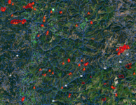
After looking at all the major mapping software's current wildfire layers, Basemaps seems to be the best. Wildfires can be your best friend or your worst enemy. This year might be the latter for me and my hunts.

Praying for all the wildland firefighters, they don't get paid enough!!
 

Attachments

  • Wildfires.png
    Wildfires.png
    1.3 MB · Views: 45
Last edited:

granite7

Lil-Rokslider
Joined
Aug 18, 2017
Messages
216
Location
Colorado Front Range
I still prefer GaiaGPS.

Here, I have current fires in dark red. Previous years’ fires in a transparent red.

Hollywood, ID area pictured

10b0d742c3b0515d3f5f2c9589ac5db8.jpg


096e0903c61d40c9b5afd0314359147e.jpg

649a79d12e202e994d4139e37ecec0ff.jpg
 

granite7

Lil-Rokslider
Joined
Aug 18, 2017
Messages
216
Location
Colorado Front Range
Those are same-day infrared mapped and they integrate right in to the rest of my waypoints, tracks, scouting photos, etc. I guess that is pretty blah
 
OP
Ryan Avery

Ryan Avery

Admin
Staff member
Joined
Jan 5, 2012
Messages
8,689
@granite7
Gaia is also missing several historic trails in the area I hunt. OnX, BaseMap, and GoHunt all have them. Really weird. But lots of people love Gaia. To each their own I guess. :)
 
OP
Ryan Avery

Ryan Avery

Admin
Staff member
Joined
Jan 5, 2012
Messages
8,689
Those are same-day infrared mapped and they integrate right in to the rest of my waypoints, tracks, scouting photos, etc. I guess that is pretty blah
That part is awesome, the detail of the maps is BLAH.
 

granite7

Lil-Rokslider
Joined
Aug 18, 2017
Messages
216
Location
Colorado Front Range
@granite7
Gaia is also missing several historic trails in the area I hunt. OnX, BaseMap, and GoHunt all have them. Really weird. But lots of people love Gaia. To each their own I guess. :)

Thanks for expounding upon your reasons. I’m surprised that they don’t have it on one of their many layers. But, I’d also be surprised if nobody has made a public track of the trails you’re looking for.
 

SawtoothShooter

Lil-Rokslider
Joined
Feb 11, 2018
Messages
255
Location
Blackfoot, ID
Fun fact, basemaps is actually what allot of our primary fire folks use in addition to our work required apps like collector. Prescouting an off forest fire before you get there and can scan a QR for some quickly thrown together 2D "map" is awesome. And when you need more detail on trails, water (drafting sites), topography/veg types/terrain, predicted wind at a closer scale than a spot weather, etc it kicks any team's GISS in the ass. Cuz remember, most offices are lucky if their latest imagery pass was done in the last decade, much less lidar, and their layer files are about as accurate as a fudd's old minute of milk jug 30-06 at the Shoshone county range in September... Ha
 
Top