Gaia vs OnX vs Huntstand

Joined
Apr 18, 2019
Messages
1,648
I know these have been discussed but wanted to share my take on them.

I’ve been using the free version of HuntStand for a couple years hunting Missouri private land and MTNF. It got the job done, but they recently locked down some of the free version features so I need to upgrade to a paid app. The three mentioned above all have the basics: Private/public parcel info, GMUs, tracking, offline maps, Topo and satellite maps, etc.

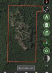
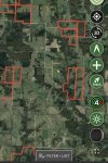
HuntStand has some features that appear to be unique (or at least I haven’t figured them out on the others). You can save “areas” including the parcel boundaries, which is very convenient. I use the wind direction predictor before and during every hunt. The waypoint marker, which I use frequently, is great. It has more maps, including one with hillshading, than OnX but far less than Gaia. It does not have a search feature like the other two, which is inconvenient but not critical. It is the cheapest app at $25 annually for nationwide access.

OnX is a bit easier if searching for areas by owner. It has a few layers that HuntStand doesn’t but less maps. It’s most expensive if you want more than one state ($99) or $29 for one state. I really don’t see much of advantage over HuntStand to justify the cost or to lose all the waypoints I have in HuntStand.

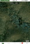
Gaia has the most features, maps, and layers by far. Some of the layers are quite cool and useful (forest service roads, road distance heat map, etc). It’s not even close compared to the other two, and you can stack layers to make it even more versatile. It does pretty much everything both the other apps do except for those feature unique to HuntStand. It doesn’t have as many hunting specific waypoints but I only really use a few types so that’s not a deal breaker. Cost-wise, it is in the middle at $20 or $40 depending on the membership level. Gaia would be a clear winner if not for one thing. .... Its satellite maps have noticeably less resolution than the other two which is a surprising bummer. See pics below. It’s hard to get over that.

Did I miss any major points?

Gaia
346E72BA-AAE3-4BB0-B29F-426068BA9987.jpeg

HuntStand
D42EB496-BE22-46B9-AC33-CBA55E26BE1D.jpeg
 
Joined
Oct 11, 2017
Messages
32
Location
Oklahoma
I started using Basemap at the end of last summer. Limited use but it has many different map layers and seems to compare with OnX but far cheaper. You may include that in your list and see what others have to say about it.
 

Brendan

WKR
Joined
Aug 27, 2013
Messages
3,871
Location
Massachusetts
Its satellite maps have noticeably less resolution than the other two which is a surprising bummer. See pics below. It’s hard to get over that.

I haven't found a difference between Gaia and OnX for the areas I hunt, but you need to try the different aerial and satellite layers to see what's better for your area

2bd1aaec240ce354e0719fc2c74a3b09.jpg
 

BaseMap

Guest
Joined
Sep 11, 2018
Messages
317
Location
Pacific Northwest
Download the free version of BaseMap and see what you think. Our Pro Membership is $30 per year for all 50 states. The Pro Membership gets you landowners names, 3D mapping on iOS, and unlimited offline maps and waypoints. You will see that our satellite resolution is extremely high resolution.

www.basemap.com
 
OP
G
Joined
Apr 18, 2019
Messages
1,648
I haven't found a difference between Gaia and OnX for the areas I hunt, but you need to try the different aerial and satellite layers to see what's better for your area

2bd1aaec240ce354e0719fc2c74a3b09.jpg

I’m sure it varies by area. I tried the three areas in MO that I hunt the most (3 separate counties) and found the Gaia was very deficient. There are areas that I could tell on the other maps that have been logged either recently or 4-5 years ago that were just a green blob like the example below. If I didn’t know that area had been logged, I might have never noticed it.
 
OP
G
Joined
Apr 18, 2019
Messages
1,648
Download the free version of BaseMap and see what you think. Our Pro Membership is $30 per year for all 50 states. The Pro Membership gets you landowners names, 3D mapping on iOS, and unlimited offline maps and waypoints. You will see that our satellite resolution is extremely high resolution.

www.basemap.com

I’m going to give it a try again. I think I did a trial of the premium earlier this year, but I got busy with something else and did not get a chance to really explore it.
 

Brendan

WKR
Joined
Aug 27, 2013
Messages
3,871
Location
Massachusetts
I’m sure it varies by area. I tried the three areas in MO that I hunt the most (3 separate counties) and found the Gaia was very deficient. There are areas that I could tell on the other maps that have been logged either recently or 4-5 years ago that were just a green blob like the example below. If I didn’t know that area had been logged, I might have never noticed it.
FWIW, I've been able to add Google Imagery to Gaia as a custom map source.

Have it syncing to iOS and the online map, but not Android yet. Haven't tried it offline either.
 
Joined
Mar 30, 2017
Messages
635
Location
Kansas
With OnX you can save maps for offline use, is this feature available with the others? Do the others operate in a web browser as well? I hate using a small phone screen if I don't have to.
 
OP
G
Joined
Apr 18, 2019
Messages
1,648
With OnX you can save maps for offline use, is this feature available with the others? Do the others operate in a web browser as well? I hate using a small phone screen if I don't have to.

They all do offline. HuntStand has a desktop version that syncs with the app and is easy to use. I think Gaia does as well but haven’t used it yet.

Maybe the BaseMap folks can clarify theirs. I can’t tell for sure but it might be a $10 yearly add on.
 

Brendan

WKR
Joined
Aug 27, 2013
Messages
3,871
Location
Massachusetts
Gaia is available offline.

Also, finally took the time to get Google Imagery working in Gaia, Android and iOS. Tested it offline too. Just need to add it as a custom map source.

Created a strava heat map overlay too....
2c51cfa78c5fc94a98333fa0643f6dd7.jpg
 

BaseMap

Guest
Joined
Sep 11, 2018
Messages
317
Location
Pacific Northwest
They all do offline. HuntStand has a desktop version that syncs with the app and is easy to use. I think Gaia does as well but haven’t used it yet.

Maybe the BaseMap folks can clarify theirs. I can’t tell for sure but it might be a $10 yearly add on.

BaseMap has an online version and also unlimited offline maps. For offline, it just depends on the storage on your phone. All of this is included in the $30/year price. The extra $10 add on you may have seen is our Hunt Research info.
 
OP
G
Joined
Apr 18, 2019
Messages
1,648
BaseMap has an online version and also unlimited offline maps. For offline, it just depends on the storage on your phone. All of this is included in the $30/year price. The extra $10 add on you may have seen is our Hunt Research info.

To clarify, it is the ability to work on a desktop (save waypoints, trails, etc) and then sync that information to the app that was in question.

For example, I used HuntStand desktop to locate benches and saddles with Topo maps in my computer because the bigger screen makes it much more efficient. I then can push those saved waypoints to my phone app.
 

BaseMap

Guest
Joined
Sep 11, 2018
Messages
317
Location
Pacific Northwest
To clarify, it is the ability to work on a desktop (save waypoints, trails, etc) and then sync that information to the app that was in question.

For example, I used HuntStand desktop to locate benches and saddles with Topo maps in my computer because the bigger screen makes it much more efficient. I then can push those saved waypoints to my phone app.

This is correct. Everything transfers between the different platforms.
 

tx_fire

FNG
Joined
Jul 16, 2020
Messages
1
Location
Texas
Not to rehash an old thread, but I was in the same boat. Downloaded and used Onx for the free trial. I liked it, gave some good info. I didn't get a chance to save the maps to my phone before I lost service so it kina messed me up there but it was a learning curve. GunsAreFun, now that its been several months, can you give an update of your opinion of them? I'm comparing basemap vs huntstand vx onx at this point. Thank you!
 
OP
G
Joined
Apr 18, 2019
Messages
1,648
I’m still using Gaia AND HuntStand if that means anything.

I will probably continue to use the free version of HuntStand for whitetail in MO. It is the simplest mapping system and the wind feature is just so nice. And did I mention, it is free lol?

I’m sure plenty of people are happy with OnX and BaseMap. I might actually try OnX next year...we will see. But Gaia does everything I need and then some. Once I loaded Google Maps into Gaia, it was golden. They do have a bug with their elevation gain feature, but they are aware of it and working on it. Other than that, it has run flawlessly on many outings.

I think if someone just wants the simplest app with some key features (including reliable offline maps), OnX is probably the way to go. Gaia is great if you want some bells and whistles and customization but are also willing to spend the time to learn those customizations.
 

corncob

WKR
Joined
May 3, 2018
Messages
302
Location
Southern San Juans, Colorado
HuntStand has some features that appear to be unique (or at least I haven’t figured them out on the others). You can save “areas” including the parcel boundaries, which is very convenient. I use the wind direction predictor before and during every hunt. The waypoint marker, which I use frequently, is great. It has more maps, including one with hillshading, than OnX but far less than Gaia. It does not have a search feature like the other two, which is inconvenient but not critical. It is the cheapest app at $25 annually for nationwide access.

When you say save areas, do you mean offline maps and layers? Or something else, like measure areas or something like that?
 
OP
G
Joined
Apr 18, 2019
Messages
1,648
When you say save areas, do you mean offline maps and layers? Or something else, like measure areas or something like that?

Well you can save offline maps but what I was referring to was more like layers.The public land I hunt near my house is a bunch of small parcels (50-500 acres) scattered amongst a bunch of private land so it’s nice to highlight just the area that I can access. See example below. 200F91D1-B042-42F9-BC81-A8C5ECA8E7F6.jpeg
(before anyone spends time trying to find these spots, these are areas I’ve never been to and don’t know if they are any good)
 
Top