Help Interpreting Aerial - Selway/Bitterroot Area of Idaho

Joined
Mar 25, 2015
Messages
60
Location
SE Michigan
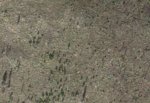
I am planning my annual trip to Idaho for spring black bear and I was hoping to get some help interpreting what I am looking at on these aerial images. Why would this area be void of vegetation? In the area I am looking, I would expect these areas to be green. I am guessing that they are burned over areas but why no green? Thanks for the help in advance.

Aerial Example 1.JPG
 
Joined
May 10, 2017
Messages
2,160
Lots of possibilities:

Time of year when photo is taken
Super hot burn that created a moonscape
No water nearby and/or poor rocky soil

I've only been in the country a little bit but I've been in the Frank slightly to the South a fair amount and the habitat is not real productive. The Idaho baolith, granitic soils stunt antler growth and affect game densities. It's a major limitation on Central Idaho that is well documented by Fish and Game and guys who've put boots on the ground.
 
Joined
Jun 24, 2018
Messages
89
It looks like a an intense burn area given the dead trees that appear to litter the area. That could be confirmed with OnX maps or the fish and game map layerfile.

Sent from my moto z3 using Tapatalk
 
OP
A
Joined
Mar 25, 2015
Messages
60
Location
SE Michigan
So it is possible for a burn to be so hot that the area either takes a longer time to recover or doesn't recover? I was kind of thinking that but wasn't sure this was a possibility.

I am curious to see what it looks like once I am on the ground. Thanks for the help guys.
 
OP
A
Joined
Mar 25, 2015
Messages
60
Location
SE Michigan
From what I am seeing on the F&G Hunt Planner Map, it is not inside of a burn area.

If I can just throw one more question out there, I've heard of glassing avalanche chutes for feeding bears. Does anyone have experience doing this? Is it something I should look at? I am guessing that is what I am looking at in this image?Avalanche Chutes.JPG
 

BluMtn

WKR
Joined
Nov 24, 2016
Messages
1,018
Location
Washington
If you are on Google earth look in the lower right corner and it will give you the date the picture was taken. That part of the country has seen a lot of fires lately and it could also be very rocky in that area. Use a side angle to give it some depth and that should help you understand the terrain.
 
Top