Right up front, I'm not very tech-savvy so bear with me. I have a Garmin Montana and have used it with different state chips on a couple of western hunts. My buddy had used Onx then. I saw lots of good reviews for GAIA and they have a great price for a year of their premium service so I got it. Figuring not having to carry the Garmin, just my IPhone.
I am working/messing around with the app a bit; one of the things that attracted me to it (and I know other brands off this, not just them) is the ability to download maps ahead of time for offline use. But I don't quite grasp how that works. I have downloaded a map of NF land, it's in my library. But how do/will I actually use it? I am going on a hunt next month here in MO in NF land where I anticipate not having cell service. If I have cell service, I would think it would work fine with it's "provided" map. But when I lose cell service, will the app "tell" me that I need to go to a previously downloaded map or do I need to recognize that and pull up a map?
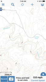
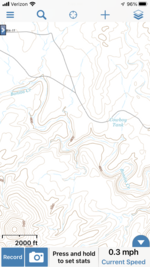
Likewise, and this has me a bit befuddled, when I have service, the map shows me where I am in real time. If I don't have service and would be working from a downloaded map, the app can't show where I am on that map since it isn't tied to a satellite at that point, right? So if I couldn't see where I am on a map then, what's the point of having the map?
I have Googled and watched some GAIA tutorial videos and just don't see this concept explained. Maybe it's real basic and a given but as I said up top, I'm not so tech-savvy.
So if anyone could maybe give me a few tips, "GAIA for dummies," I'd appreciate it!
I am working/messing around with the app a bit; one of the things that attracted me to it (and I know other brands off this, not just them) is the ability to download maps ahead of time for offline use. But I don't quite grasp how that works. I have downloaded a map of NF land, it's in my library. But how do/will I actually use it? I am going on a hunt next month here in MO in NF land where I anticipate not having cell service. If I have cell service, I would think it would work fine with it's "provided" map. But when I lose cell service, will the app "tell" me that I need to go to a previously downloaded map or do I need to recognize that and pull up a map?
Likewise, and this has me a bit befuddled, when I have service, the map shows me where I am in real time. If I don't have service and would be working from a downloaded map, the app can't show where I am on that map since it isn't tied to a satellite at that point, right? So if I couldn't see where I am on a map then, what's the point of having the map?
I have Googled and watched some GAIA tutorial videos and just don't see this concept explained. Maybe it's real basic and a given but as I said up top, I'm not so tech-savvy.
So if anyone could maybe give me a few tips, "GAIA for dummies," I'd appreciate it!