Old logging site?

Finch

WKR
Joined
Feb 12, 2014
Messages
1,293
Location
VA
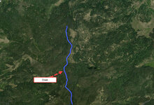
Does this scream logging site to anyone else or just some kind of crazy backcountry road system? East of the creek. I came across this in my map scouting. This is CO. There is a creek that borders the thick timber and the more open area close to the roads. This is not a wilderness area so I'm afraid ATV traffic may be heavy here. I realize no one can answer that but back to my original question. Look like a logging site?
Map.jpg
 
OP
Finch

Finch

WKR
Joined
Feb 12, 2014
Messages
1,293
Location
VA
Find it on Google Earth and use the history slide.
Now there's an idea! Admittedly, not the best at google earth but do know how to do that. The image quality has definitely improved throughout the years. Thanks
 
Joined
Sep 13, 2016
Messages
2,085
Location
Idaho
Most definitely a log sale. The lines are skid trails and the bigger openings that the lead to are log landings where they processed and loaded trucks.
 

BCSojourner

Lil-Rokslider
Joined
May 24, 2018
Messages
201
Location
Kremmling, CO
Here are a couple of recommendations-hope they are helpful. To determine volume of ATV traffic, you can typically access the USFS travel map for this Ranger District via the applicable Forest website. CalTopo which is a free download also frequently has this information that you can use in conjunction with GE, although their travel route information may not be as recent or accurate as the Forest travel map. Although this area has a road system that was obviously developed for timber harvest and management, many of these roads, including the primary access or "trunk" road may now be gated and closed to motorized use to provide a wildlife habitat buffer. A USFS travel map for the area and/or CalTopo should indicate current access status. You may be able to contact the local District Ranger office and acquire a hard-copy travel map directly from them. There are also hunt unit maps available for hunt units in CO that are well-done, available in many locations (not sure about ordering on-line), and fairly accurate with regard to travel and access route status. This is all stuff you can do from your home before you ever put boots on the ground.
 
OP
Finch

Finch

WKR
Joined
Feb 12, 2014
Messages
1,293
Location
VA
Here are a couple of recommendations-hope they are helpful. To determine volume of ATV traffic, you can typically access the USFS travel map for this Ranger District via the applicable Forest website. CalTopo which is a free download also frequently has this information that you can use in conjunction with GE, although their travel route information may not be as recent or accurate as the Forest travel map. Although this area has a road system that was obviously developed for timber harvest and management, many of these roads, including the primary access or "trunk" road may now be gated and closed to motorized use to provide a wildlife habitat buffer. A USFS travel map for the area and/or CalTopo should indicate current access status. You may be able to contact the local District Ranger office and acquire a hard-copy travel map directly from them. There are also hunt unit maps available for hunt units in CO that are well-done, available in many locations (not sure about ordering on-line), and fairly accurate with regard to travel and access route status. This is all stuff you can do from your home before you ever put boots on the ground.
Thanks for this! Looking into this now.
 
Top