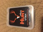
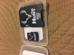
onXmaps Hunting GPS Maps Garmin Utah Public/Private Land Topo HUNT-UT-SD Card
Asking $60 TYD. PayPal gift.
Purchased September 2015. Hunted Colorado instead. Basically new never used. Paid $100.
Land owner name appears on parcels within the state
Utah-specific
Guzzler locations
Color-coded land ownership data
Bureau of Land Management
State Land
State Parks
County Land
National Park Service
WMA, WPA, NWR, etc.
US Forest Service/National Grasslands
US Fish & Wildlife
Indian Reservations
DOD—COE-US Gov
Bureau of Reclamation—BOR
Local government
Much more!
Hunting Unit boundaries
Use your GPS to select anywhere on the map to list Antelope, Elk, Bighorn Sheep, and Mule Deer Hunt Unit information
24K topographic features (20 ft contour intervals ~ 1:24K Equivalent)
Wilderness Area boundaries
Section lines and numbers (T24N R34E 12)
City parks, county open space
Roads—Highways, city and county roads, USFS roads and trails, Nat'l Park trails, OSM trails, Nat'l Wildlife Refuge road & trails, BLM roads
National Forest roads, trails, and recreation sites
Campgrounds
Geographic names (cities, creeks, manmade features, etc)
Water—detailed data on rivers & streams, lakes, reservoirs, salt flats, springs, hot springs, and guzzlers
Bathymetry—20-foot depth contours in Lake Tahoe and Lake Mead (from the reservoir's average water elevation). Do not use for navigation.
Fishing access sites (boat ramps)
Bankhead Jones
Map Coverage: Utah