Using map and compass for backpack hunt

Clrems77

WKR
Joined
Nov 29, 2019
Messages
408
I’m hoping to do an OTC backpack solo hunt this year and was looking for some advice from you seasoned guys.

Ive been pretty fortunate to hunt western areas that are pretty open with success using my GPS and phone, but wanted some experience with map and compass for heavily wooded back country this season.

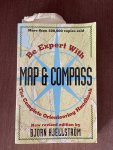
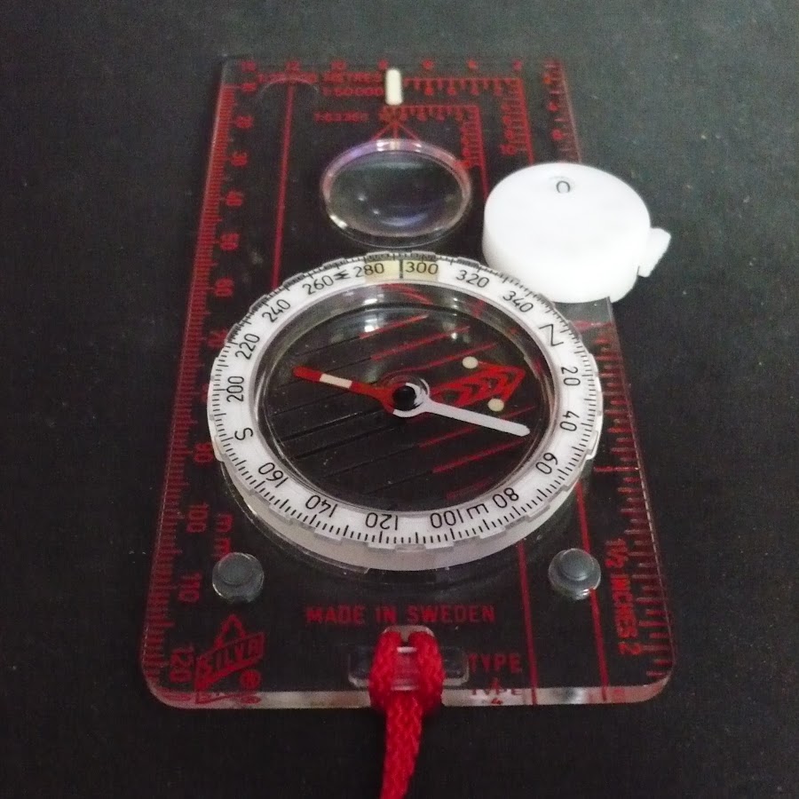
Could you knowledgeable navigators throw out some suggestions on decent compasses, which maps work best/easiest for a newbie and any suggestions on classes or ways to learn quickly without breaking the bank?

Thank you In advance!
 
Joined
Jan 23, 2014
Messages
363
Location
AZ
I watched Andrew Skirka on YouTube and went off of his suggestions. Get a good compass with adjustable declination. I would suggest getting a map where you live close by and practice. Not that difficult but it fades when you don't use it. Im not sure about wooded areas, I feel like I would need some line of sight to landmarks, guess Ill have to look into that problem myself. Hope there are some other good media suggestions.
 

Voyageur

WKR
Joined
Feb 12, 2020
Messages
1,017
A simple basic book that will give you a great start.
 

Attachments

  • 8D3CA0A7-C3FD-4242-A255-639B023A0C88.jpeg
    8D3CA0A7-C3FD-4242-A255-639B023A0C88.jpeg
    470 KB · Views: 35
Joined
Apr 14, 2020
Messages
26
My topo. com for topo maps, I get and use the UTM grid. But have Lat, long tick marks put on the map just to have them.
Map tools. com for the map tools to navigate. Its based off the scale of your map, I get the square ones, not the rulers. He has a cheap book on navigating using the different methods UTM, LAT/ LON and another one last I saw. I find my location coordinates with a GPS then locate myself on the map to plan my moves when scouting.

Sent from my SM-G930V using Tapatalk
 

11boo

WKR
Joined
Feb 24, 2016
Messages
2,332
Location
Grand Jct, CO
I cut my land nav teeth with map and compass only. Your best bet is to get topo maps with no more than a 1 to 100k scale, and 1 to 40k are really nice. Problem is you will need a pretty good bunch of them. The 1 to 40k will cover a really small area but have incredible detail.
in thick timber you will be nearly blind with the map, as finding landmarks to shoot an azimuth to will be hard. A known pace count( how many steps to go 100 yds) will help you find where you should be, along with following a compass bearing.

i applaud you for trying this lost skill. You could do it with a good lensatic compass like an old GI surplus one with the sighting arrangement and a map protractor. There is a small correction going from a magnetic azimuth to a grid azimuth, it will be shown on the map info. Your key to success will be finding the maps with the smallest scale.
 

Wrench

WKR
Joined
Aug 23, 2018
Messages
5,668
Location
WA
I have silva Forrester that was great until last year. Apparently they only last about 30 years.

One issue you'll have with heavily wooded backcountry is the ability to pick landmarks gets tough when you can't see any.

When I have to rely on compass in thick stuff, I take notes on travel time and direction until I can get to a landmark.
 
Joined
Jul 7, 2018
Messages
941
Location
Montana
Suunto M3-G for a baseplate compass, or MC2 USGS for a mirror compass. I use both.

Youtube channels “Maptools” is very good for UTM grid learning, and Columbia River Orienteering Club has great videos for baseplate compass fundamentals.

MyTopo custom a map for your hunt area. I bring several maps of different size. If I want to really narrow my location down without triangulation I will take the UTM number off my Garmin 401 and find my spot using the map and a template, then use the compass to head off to my next location.

practice, practice, practice...and trust your equipment
 
Last edited:

Bighorner

WKR
Joined
Nov 15, 2017
Messages
562
If you are going to put all your eggs in the compass and map basket, which is 100% doable, make sure you have your ducks in a row before it gets dark and you have to get back to camp.
 

*zap*

WKR
Joined
Dec 20, 2018
Messages
7,122
Location
N/E Kansas

All you need to know is clear concise learning format. Around 100 short videos.
 
OP
C

Clrems77

WKR
Joined
Nov 29, 2019
Messages
408
If you are going to put all your eggs in the compass and map basket, which is 100% doable, make sure you have your ducks in a row before it gets dark and you have to get back to camp.

Definitely not that confident in my back country skills 😂 I’ll have a phone and Garmin but thought the more knowledge the better.
 

BowTrout

FNG
Joined
Dec 1, 2019
Messages
98
I’m interested in learning this as well. I don’t think it’s something that I really need to learn but it seems like a good skill set to have.
 

Indyal

Lil-Rokslider
Joined
Feb 15, 2020
Messages
146
Google “back country navigation part 1 Kifaru” and part 2. It’s an old article so some of the references to online sources may not be valid. I like map, compass and use an iPhone app
 

GotDraw?

WKR
Joined
Jul 4, 2015
Messages
1,297
Location
Maryland
My brother and I carry GPS and map/compass. Map and compass can be a challenge at night, in the rain, wind or when you can't quickly get your map(s) out. We can navigate via either, and generally use a hybrid approach to save GPS batteries. We mostly use the GPS to quickly:
  1. Mark and label a point of interest, camp, or way point
  2. Show azimuth to a desired destination (as in one of the above)
  3. Show elevation
We use topo maps when we want to plan a course to a new destination and don't want to waste GPS batteries trying to view/understand local topo and hikable contours.

Garmin GPS systems allow you to set a custom home page with up to 6 fields displayed. I have found it *EXTREMELY* helpful to set the homepage of my GPS so it immediately and continuously displays the following 3 data fields:
  • Azimuth to next destination
  • Distance to next destination
  • Current Elevation
Each GPS is different, and some are a real PITA to program, but if you program the HOME page of your GPS to display the 3 above then you will be able to instantly get the most important information you really need to navigate w/o burning GPS battery to flip through screens.

Once you have the azimuth to next, then turn off the GPS to save batteries and use your compass to navigate the Azimuth by sighting and navigating to successive visual marks along the Azimuth.

I've used MYTOPO to cheaply print many custom maps on 11"x17" waterproof paper with waterproof ink; however, they've recently discontinued the mapping tool I use and I'll have to find an alternate.

Get that GPS set up well and you'll get the info you need w/o wasting a lot of battery time.

Best,

JL
 
Last edited:
OP
C

Clrems77

WKR
Joined
Nov 29, 2019
Messages
408
Thank you everyone for all the great info!! Now I’ve got a decent starting point.
 

SoDaky

WKR
Joined
Apr 6, 2018
Messages
670
Location
sd
You will(should) learn to travel in heavy timber with just the map-assuming the country is varied enough terrain wise.If flat,good luck.For instance I used to travel areas like the Panhandle in Idaho or the jungles of NW Mt with just a good topo map and a plain Silva.That is in daylight.After dark is,as indicated,much different.The phrase 'stay tuned' is more than bow advice,stay aware of where you are as you move.Periodically verify.
If base is on a road,easy to hit the road in the dark but then-'which way do you go?'Again the map will eventually tell you but you may travel the wrong way a half mile or so first.If base is a tent in the middle of nowhere,entirely a different matter.Even after years of doing it I always strung a series of colored 'tape' about 100 yds out from my tent in every direction.Waist high so light hits it.There was an occasion when that may have been a lifesaver in Colorado.Soaked and wet snow after dark.Received about 8 inches that night.
A great skill to have,good on you for trying.
 
Top