You are using an out of date browser. It may not display this or other websites correctly.
You should upgrade or use an alternative browser.
You should upgrade or use an alternative browser.
Contour elevation lines for google earth and/or maps
- Thread starter buck34
- Start date
Tod osier
WKR
- Joined
- Sep 11, 2015
New to this forum so hope this is right catagory for this post. Is there an app or program that will put accurate contour lines onto Google Earth or Maps?
I've always thought this would be great. Never seen it, but haven't looked very hard.
mcr-85
WKR
- Joined
- May 28, 2014
- Location
- Southern Utah
flyinsquirel
WKR
- Joined
- Jul 3, 2012
- Location
- Central Cal
I use Earth Point same as mcr-85. It's a little wonky though as in some areas the elevations are in meters and in others it's feet.
I'll have to take a look at toprut.
I'll have to take a look at toprut.
Yes, you can sign up for caltopo, build out your map with whatever layers you like. Save the map, click on 'download network link', and then open that file it gives you in google earth. It will then show you all your caltopo layers on the left hand panel of google earth. You can turn them on and off. Be patient as it loads them live over the internet. Any changes you make in caltopo, including layers, way points, etc will automatically be available in google earth. I use it all the time.
I like Idaho hunt planner.
IDFG Hunt Planner Map Center
You can build custom maps of an area (any scale/size/topo or satellite), then you can annotate your anticipated approach route, planned spike camp locations, waypoints, label basins you intent to hunt, etc. I leave a copy with wife and a trusted buddy. If I get cell coverage, I can text updates using the labels to give them a good idea where I'm at.
Worth checking out. All pretty simple and various map datum's give some great ways to compare terrain.
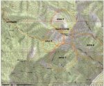
Here us a sample map (not my honey hole and hopefully not yours)!


Last edited:
wapitibob
WKR
- Joined
- Feb 24, 2012
- Location
- Bend Oregon
Again, toprut.
All toprut overlays reside on your pc so if you use a laptop you can have it in camp and have access to everything but sat imagery without internet.
All toprut overlays reside on your pc so if you use a laptop you can have it in camp and have access to everything but sat imagery without internet.
Again, toprut.
All toprut overlays reside on your pc so if you use a laptop you can have it in camp and have access to everything but sat imagery without internet.
Good info. Thanks
Similar threads
- Replies
- 6
- Views
- 136
- Replies
- 15
- Views
- 2K
- Replies
- 9
- Views
- 130
- Replies
- 13
- Views
- 401
Featured Video
Stats
Latest Articles
-
The Highway and Mule Deer With UDOT’s Matt Howard
-
Argali Talus Review
-
Among the Old Oaks and Fallow Deer
-
Hunting Big Mule Deer: Ambush Hunting
-
TT#30 Bow Tuning with Daykota Kime and the Cold Bow Challenge
-
What Winning Looks Like, with Dan Gates
-
Maven S.3A Spotting Scope Review
-
TT#29 Everything Kifaru with Aron Snyder and Anders Christianson
-
Rocky Mountain Big Game Recovery
-
Gunnison Mule Deer and Beyond with Brandon Diamond
