The onX Hunt review & question thread, by Rokstaff & Members

robby denning

Administrator
Staff member
Joined
Feb 25, 2012
Messages
14,994
Location
SE Idaho
attachment.php

Hey all,
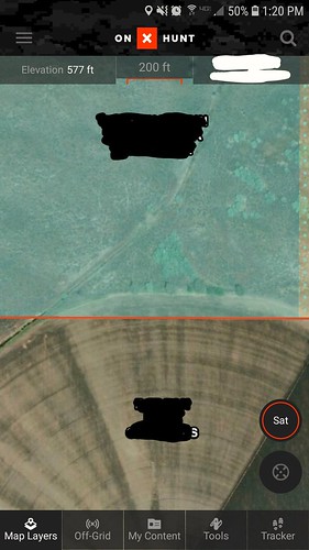
some will say that one of the true advances in Western hunting in the last decade is the onX Hunt products (GPS chip and phone apps). To me, no other product has made navigating units, hunt boundaries, private/public interface easier than onX. Even state trespassing laws are being influenced by this technology--there's no excuse to not know where you stand.

Several of the Rokstaff have been using the onX Hunt app/GPS chip for years, but several more of us came on board this spring. Les Welch will have a full review up in early August (and he'll be giving away one Elite Membership to onX Hunt).

We figured it would be good to get a Q&A-type thread going for this forum where members can read our experiences and of course post their own. I dragged my feet to get going on this technology, but once I started using during the spring this year, I don't think I'll ever stop, just too many advantages.

If you're interested in learning more about it, just subscribe at Thread Tools above.

Anyone is welcome to post if they have considerable experience with the product. Although it's pretty easy to use, there is a minimum experience level needed before providing feedback, so please make sure you have that. For me, it was about three trips out before I could use everything well.

attachment.php
 
Last edited:
OP
robby denning

robby denning

Administrator
Staff member
Joined
Feb 25, 2012
Messages
14,994
Location
SE Idaho
Safe to say I have about 20 days on the onX app now, between shed hunt, scouting, trail cameras, and just playing with it in town.

I end up in a lot of the same areas every year, so I'm not coming from the perspective of a new hunter in new country. However, I've really liked knowing exactly where the private meets the public. Idaho just changed it's law, in part based on this type of technology, so that not every fence has to be posted to keep you out. I've already identified a few fences that are on private that are not posted, but now by Idaho law, that doesn't matter.

I'm using the app on my iPhone 6s, not the GPS chip. My GPS is an eTrex and is almost 16 years old. I've been thinking I need to upgrade but at this point, I'll wait as my iPhone is still usually with me on all hunts and now doubles as a GPS.

Remember, if you have the app, it will work on multiple devices. I use my PC to log into my account when I want to look at areas I've scouted and marked up but on a bigger screen than the iPhone--super super handy! I can just scout and make waypoints, tracks and just look at the big picture once I'm on my PC. I've already built a pretty considerable library of data for several areas, like water sources, access points, and buck sightings.

I have the Elite version, so access to all 50 states. I also have a few of the extra layers: Eastmans, B&C, and of course the public land layers.

The Eastman's show trophy potential but if I'm reading it right, I think the B&C has more coverage of the West--someone correct if I'm wrong! I'm color blind so I might be missing something.

I read on the other thread of some glitches, but I've had none on my iPhone 6s. I have had a glitch when I got to my PC. If I zoom in very close, say less than 2000 feet, it reverts to "Topo" and I can't use satellite. I haven't made time to call CS but will.

I've used the app out of cell service a lot. You just have to download the area before you go. It takes a few minutes and some space on your phone, but is totally worth it if you're area is out of service. Just make sure once you're on the mountain, you put your phone in airplane mode and it will revert to communicating with the satellites (if you don't go in airplane mode, app tries to use cell service and maps come up blank or partial.)

I've also figured out (once) how to transfer my onX info onto Google Earth Pro. onX doesn't have a tilt function like GE, so once I merged the two, I can really see the country. I wouldn't dare coach anyone on how to do it, but I figured it out within about 30 minutes.

I'll report more as I use it more.
 

Brock A

Super Moderator
Staff member
Joined
Apr 30, 2012
Messages
2,917
Location
Buckley, WA
Long time On X user here, like back before it was called On X. Anyway, I have used it extensively the last few years for "E-Scouting". Its truly an incredible tool. I have used it for discovering trails I didn't know were there, bushwacking into basins, I have even used for work to find out who owns some land. Anyway, one thing I wanted to touch on was how much I used it this past season for upland bird hunting. Pheasant and quail happen to love farmers fields, haha. I came across one area that I felt the farmer had his temporary hot fence pushed pretty far past his field, like past the ditch line, basically 30 or 40 yards from really good cover on the edge of his field. I pulled out the On X, and sure enough, his field was actually plowed and planted way past his property line. Now out of respect, I did not hunt into the field, and I am sure the farmer has no idea he is past his property line, but you can bet your ass I hunted the edge of the field several times. See the picture to illustrate what I am talking about.


Moral of the story, my dog is happy!!!
 

Jskaanland

Administrator
Staff member
Joined
Mar 19, 2016
Messages
1,700
Location
Washington
I've used OnX for a little over a year. I used it during an Idaho and Washington archery seasons last year, tagging camp, water sources and some wallows for the future. During the Washington modern firearm season, I used it to get around and above two bucks I saw across a draw fighting on some Feel Free to Hunt property I was on with my boys. My goal for that day was just to get both of my boys out(5/7 at the time) and watch some deer. Using onx I was able to see where the property just touched the main road, so we were able to come in from above and up wind from the deer.

HNnjYHAl.jpg

ra8sPH9l.jpg
 

MIKEYB

WKR
Joined
Aug 29, 2012
Messages
312
I have had a chip in my GPS for several years and last couple of years using the Earthmate map paired with my phone.

This year I subscribed to OnX in additon, Used randy's discount code. thanks Randy! I owe you a blizzard.

I like the functions and ease of use though I'm still getting the hang of it.

Had a discussion with a older family member about a unit I am hunting and thoughts on a spot for backpacking in. He said that it was too far from my unit and not worth it. I pulled out the Ipad and fired up Onx and I don't think he really wanted to believe that the spot was in the unit. " they must have changed the boundaries since I hunted there, I even talked to the warden"

One thing that I have enjoyed recently is the precipitation layer. I can watch real time radar of the unit now that the monsoon has kicked in and keep an eye out on which parts in the unit are getting water. one less tab to have to open.
 

MIKEYB

WKR
Joined
Aug 29, 2012
Messages
312
One thing I was looking for is the ability to change the dates of the satellite imagery to view different years and seasons?

Anyone know if this is possible with this application? desktop or mobile?
 
OP
robby denning

robby denning

Administrator
Staff member
Joined
Feb 25, 2012
Messages
14,994
Location
SE Idaho
I have a question. I scouted an area last week with no cell signal so used my onX in offline mode. Now on my PC I don't see any of my waypoints that I made. Those have always been there with no action by me, but those times I believe I had cell service and was not in offline mode. Does anyone know what I'm doing wrong or how I can get the new waypoints to transfer to my PC?
 

jeremy.b

Lil-Rokslider
Joined
Mar 14, 2016
Messages
173
Location
N. Idaho (back to home finally!)
I have a question. I scouted an area last week with no cell signal so used my onX in offline mode. Now on my PC I don't see any of my waypoints that I made. Those have always been there with no action by me, but those times I believe I had cell service and was not in offline mode. Does anyone know what I'm doing wrong or how I can get the new waypoints to transfer to my PC?

Is the app still in offline mode? If it is I would assume it won't upload the waypoint data for use on the website. Disabling offline mode probably would do the trick.

Also, I've harassed the onx support team about a number of issues and they have been very helpful and responsive.
 

onX Hunt

Lil-Rokslider
Joined
Jun 17, 2015
Messages
235
Location
Montana
I have a question. I scouted an area last week with no cell signal so used my onX in offline mode. Now on my PC I don't see any of my waypoints that I made. Those have always been there with no action by me, but those times I believe I had cell service and was not in offline mode. Does anyone know what I'm doing wrong or how I can get the new waypoints to transfer to my PC?

Hello Robby,
The waypoints you marked in offline mode should sync automatically once you open the app when you return to service, however if they are not showing up on the Web Map, follow these steps to manually sync them up.

1. Open the "My Content" menu in the onX Hunt App.
2. Press your finger to the screen in the center of the menu, and swipe down.
3. A white loading wheel will appear as the program syncs your content.
4. Then open up the Web Map (if you are automatically logged in, then log out and log back in and your content will appear)

Let us know if you run into anything else or if you're still having issues.
Thanks!
 
OP
robby denning

robby denning

Administrator
Staff member
Joined
Feb 25, 2012
Messages
14,994
Location
SE Idaho
The onX Hunt review & question thread, by Rokstaff & Members

hey helsyeah onX, thanks. I’ll try all that and report back


Sent from my iPhone using Tapatalk
 
Joined
May 3, 2018
Messages
83
Location
Kansas
One thing I was looking for is the ability to change the dates of the satellite imagery to view different years and seasons?

Anyone know if this is possible with this application? desktop or mobile?

I emailed support a similar question, here was their response below.

Hello and thank you for reaching out. Unfortunately, there is no way to change the displayed season for the imagery. These images come to us from a 3rd-party vendor, and they recently did a major update. Ever since then, we’ve noticed some spots with cloud and snow cover, and some areas with poor resolution at high zoom levels. We are currently in the process of finding a different source for our satellite imagery, and we should have it updated soon. Thanks for your patience and understanding while we take care of this issue!

In the meantime, we suggest using the Topo basemap to help give you an idea of the terrain. Click here for instructions on how to use basemaps.

Sounds like it's only a matter of time!
 

DerkPerk

Lil-Rokslider
Joined
Jun 21, 2018
Messages
104
The onX Hunt review & question thread, by Rokstaff & Members

Edit: More thoroughly read the post above. Thanks for sharing your response.

First time OnX user here. I’ve been e-scouting the last few months throughout Idaho. Recently the satellite mapping has changed or updated and now I have quite a bit of snow cover on all zoom levels except for the closest in. Very difficult to see trails and such. This only happens on my pc, I’ve been using the hybrid map. Thanks


Sent from my iPhone using Tapatalk
 
Last edited:
Joined
Mar 6, 2013
Messages
3,030
Had a chance to take a short hike last night and hang a camera using the app along with my gps and chip. I have to take a roundabout way to my camera to avoid some private land. I hike right down a fenceline and my camera spot and treestand are a little ways off the fence. Both the app and GPS w/ chip showed I was on the correct side of the property line hiking the fenceline like I always do. The app seemed to take more data points on my trail and showed everywhere I zig zagged side to side going around stuff. The GPS and chip were pretty straight for the most part. I'll look into my GPS settings and see if there is a tracking frequency option. The app did temporarily freeze up on me but I didn't put it in airplane mode either. I figured I should be alright the whole way and had it loaded on Wifi before I headed out. Had 3G plus cell coverage the whole way. I would just have to stop and wait for the app to load and see where I was and the GPS is just always ready and instant to take a glance at. Next time I check the camera I will put the app in airplane mode and see if it is more on par with the GPS for getting a quick reference. Once I was back at my starting location I was standing in the yard and realized I was pretty close to a known surveyed property line so I pulled both phone app and GPS out which were still running and checked my location. This time they placed me on the wrong side of the line by a decent amount, I kept both open and watched as the GPS location crept back toward the line but continued to show me on the wrong side even though I know I was standing 10+ feet on the correct side. The app never really updated my position while watching and I'm thinking that is due to the more frequent tracking timestep.

Fenceline showing correct side and winding on app
You can see the fence as the straight orange line on the app and straight black on GPS. App shows more accurate winding track.
App Fenceline Name Crossed Out.jpg IMG_9601.jpg

This is after I was finished and standing on the correct side of the line and both app and GPS showed incorrect side of line.
I should have been showing to the left of the line.

Parents Name Crossed Out.jpgIMG_9603.jpg
 

Glendon Mullins

Hillbilly Moderator
Staff member
Joined
Sep 7, 2014
Messages
2,125
Location
Highland County Virginia
Hey there, Glen Mullins, Rokslide Staff here bringing you my take on the onX Maps App.


So far I have been utilizing the onX Maps App to do some cyber scouting for my upcoming Mule Deer Hunt in Montana, which will get its own review article here on Rokslide, the article will be from a "First time out west hunting, from an Eastern Hunter's perspective" using onX Maps. With the goal being to show what an asset onX Maps is for eastern hunters going out west. I will be using all facets of the onX Maps system, on my laptop cyber scouting from home, the App on my cell phone, and the GPS Chip as well.


In the meantime, before that hunt, I have used onX to do some scouting around my core area of hunting out here in Virginia/West Virginia in the east. I have found onX to be very helpful in this regards. Of course the one area that onX shines, which has been mentioned previously, is the ability to find unknown, or little known access to public lands. I honestly didn't know how many spots I would find like this here, because generally here in the east, national forest is usually well marked and private land has to be posted. However to my surprise I have found several "unknown" (at least to me) access spots. One such I found on the very road I live on here in Virginia. I have driven this road 100's of times and I always thought it went through all private lands. As you can see in the following picture, the one curve in the road actually joins National Forest. I plan on checking this spot out on foot in the near future. I am not going to spend a lot of time on this as, like I mentioned before, this is probably the top reason most people choose to use this app in the first place.
View attachment 77110

One thing about onX that I rarely see get mentioned, yet I have found very useful is the different layers you can cycle your maps through. You have you normal Satellite Imagery, Topographical Maps, and a Hybrid between Satellite and Topo. I like to use the Topo selection, and you can keep the public/private land boundaries on while using it as well. In the east, us whitetail hunters like to find saddles, flats and other topographical features such as those to target whitetails in the Appalachian Mountains. Topo maps are a great tool for this. This just adds more “bang for your buck” to onX Maps for me and makes it a useful tool for the Eastern Whitetail Hunter on blocks of road-less national forest just as much as it is a useful tool for the Western Hunter on small patches of scattered public land.
View attachment 77116
 
Joined
Aug 17, 2015
Messages
1,962
Location
Iowa
Been using OnX now for 3-4 years and think its pretty awesome, but I have 1 criticism since the last big update. When adding waypoints, doing area shape, or line distance, I wish the "Save" and "Undo" buttons didnt have to be right in the middle of the screen. Makes it really hard to work on the screen.
 
OP
robby denning

robby denning

Administrator
Staff member
Joined
Feb 25, 2012
Messages
14,994
Location
SE Idaho
Doverpack, good observations. I’ve pretty much concluded that if my cell service is sketchy, I have to put it in airplane mode and use my downloaded map to keep from freezing up. It’s got to be the weak cell signal. And by putting it on airplane mode, I can just communicate with the satellites.


Sent from my iPhone using Tapatalk
 

JC01839

FNG
Joined
Jul 26, 2018
Messages
5
Location
Ohio
Anyone have experience saving maps to an SD for use with a handheld gps? I am aware Onx sells state map chips, however I am already an Onx member, and really only require a map of 1-2 areas for use on my handheld GPS. Just curious if anyone had saved maps and transferred to a handheld previously or if Onx has this feature locked?
 

Jskaanland

Administrator
Staff member
Joined
Mar 19, 2016
Messages
1,700
Location
Washington
Anyone have experience saving maps to an SD for use with a handheld gps? I am aware Onx sells state map chips, however I am already an Onx member, and really only require a map of 1-2 areas for use on my handheld GPS. Just curious if anyone had saved maps and transferred to a handheld previously or if Onx has this feature locked?

Are you trying to save a map from the app on your phone to an sd card to put onto a GPS? If so, the last time I asked OnX they told me, you can't save any of the offline maps to your phone's SD card.
 

KHNC

WKR
Joined
Jul 11, 2013
Messages
3,426
Location
NC
So, i did the latest update on my iphone this past saturday. I downloaded a new map for GA public area. Once i arrived on location, i found out my app had the same issues as a few weeks ago. Off grid maps not working properly. Fortunately, it did not affect my wyoming maps i DL'd after the prior fix. I deleted the new map and will deal with the issue once i return from Wyoming. Just a heads up, i would be leery of this update.
 
OP
robby denning

robby denning

Administrator
Staff member
Joined
Feb 25, 2012
Messages
14,994
Location
SE Idaho
thanks for the heads up KHNC...I'm sending your post to onX

One other thing I’ve found I really like is now I always have a “gps” on me (my phone) and not have to carry two devices. To be able to drop my pack or boots for a stalk and not have to worry about finding them is a benefit I didn’t realize till I got the app.

I was less than 20 feet from my pack and couldn’t see it. Pulled up the app, and couldn’t believe I was almost standing it

cd9056d95947a4de9c699e94d26f5c95.png


Prior to onX, I only really had a gps on me if I was in a brand new area.


Sent from my iPhone using Tapatalk
 
Top